
Well, that’s strange.
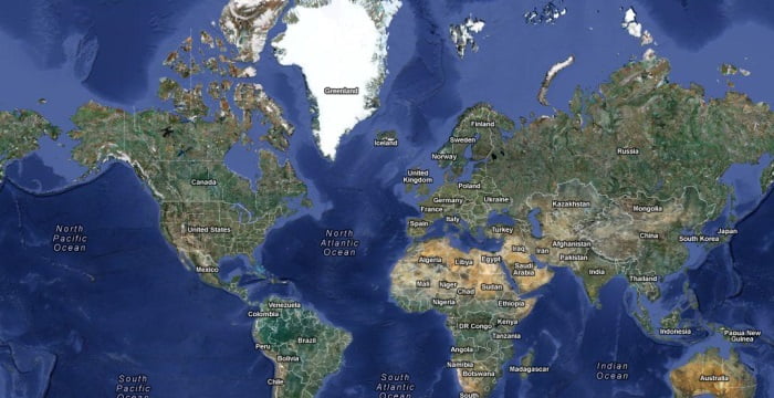
Why doesn’t Google Maps show the North Pole?
The answer’s actually pretty simple: Our Earth is round, and not effectively represented by a two-dimensional map. Google Maps uses a Mercator projection, flattening the Earth and stretching it horizontally and vertically, as do most 2D maps. Because of this, either pole invariably gets lost in translation.
“…the Mercator projection distorts the size and shape of large objects, as the scale increases from the Equator to the poles, where it becomes infinite.”
Yeah, that’s a problem.
But wait! What about Google Earth? That’s spherical…

Hmm.
Despite Google Earth showing our planet in 3D, its images are still created using the same satellite imaging, just wrapped around a 3D sphere. So we run into the same problem as with our 2D Google Maps.


