Researchers have just discovered that a small island in the South Pacific, visible on Google Maps and other charts, apparently doesn’t exist.
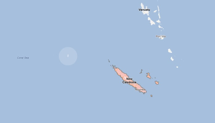
It’s called Sandy Island, and (should be) situated northeast of Australia, off the west coast of New Caledonia. You can see it clearly on the Google Map image above, just a relatively small speck of land, which I’ve highlighted. But a recent expedition to the area found that it isn’t there.
See for yourself: The lost island on Google Maps

So what happened to it? Did it simply vanish?
It’s possible, as some claim, that the existence of the island on certain maps and not others could indicate a map maker’s mark, in which a cartographer added a phony island to the original map as a form of copyright. Any other maps containing the mark would then be instantly recognizable as copies.
An Auckland librarian also found evidence of Sandy Island on a chart dating back to 1908.
It’s strange, though, looking at Google’s satellite images of the area. The island almost looks like it’s been painted over with black. Erased.
Maybe it’s a glitch.